|
IRISH PLACE NAMES |
|
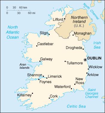
As was explained in the previous lesson, places in Ireland are troublesome at first. From a genealogist's standpoint, the most effective way to understand Ireland is to realize that it is made up of: 4 Provinces: Connaught, Leinster, Munster and Ulster 32 Counties that started in the 12th century 327 Baronies that were a subdivision of a county that is now obsolete but in the 19th century was widely used. Today it is replaced with the Poor Law Unions. 2,508 Civil Parishes that span across both barony and county boundaries. Church of Ireland parishes usually conform to the Civil parish but the Roman Catholic normally do not except in those areas that are many Catholic. Usually Catholic parishes are larger. The Roman Catholic Church due to the reformation in the 16th century adapted to a new structure centered on towns an villages. Londonderry has been subdivided into 46 Civil Parishes. Thus the need to find the proper parish for your ancestor. 60,462 Townlands further divide the rural areas of Ireland. Sources such as Griffith's Valuation help to identify the exact place of residence of an ancestor within a parish. The townland is the most ancient of Irish land divisions and the smallest. These townlands were named early and often expressed the environment surrounding the area. They vary greatly in size with the largest normally referring to the least fertile areas. The Gaelic names of these townlands were anglicized so it is important to read early histories on the name to understand their relevance to your Irish ancestor. This is true of other nations that were conquered at one time or another. You must understand the history. The last jurisdiction, is the Poor Law Union. This is the locality reference provided in the Census of Ireland records. Especially helpful are those 1901 and 1911 census records that are available now online. Check the registrar district to obtain the Poor Law Union. This was the reference point provided for the indexes.
By using Griffith's Valuation Maps, by understanding the purpose of the maps, and by using aids to understanding the information on the maps, you can identify with accuracy the location of the ancestral home, even if it is now long gone. But that is a discussion for another day. Many place names do not appear on maps, but are written in the records. And since Ireland was divided into a number of administrative divisions which form the geographical basis for research, the more precise and localized your knowledge of the address of your ancestor (townlands in rural areas, streets in towns, or parish), the better your chances of finding the family in the records of Ireland. It is important to have access to a couple of good geographical reference books for Ireland including: General Alphabetical Index to the Townlands and Towns, Parishes
and Baronies in Ireland published by Genealogical Publishing
Company. A copy is available in the Family History Center in Monterey and in the Family History Library.
Also MOST helpful, is A New Genealogical Atlas of Ireland
by the same publisher available in many genealogical libraries. |
|
|